Hydrologic &
Soil Surveys

Wetland Delineation
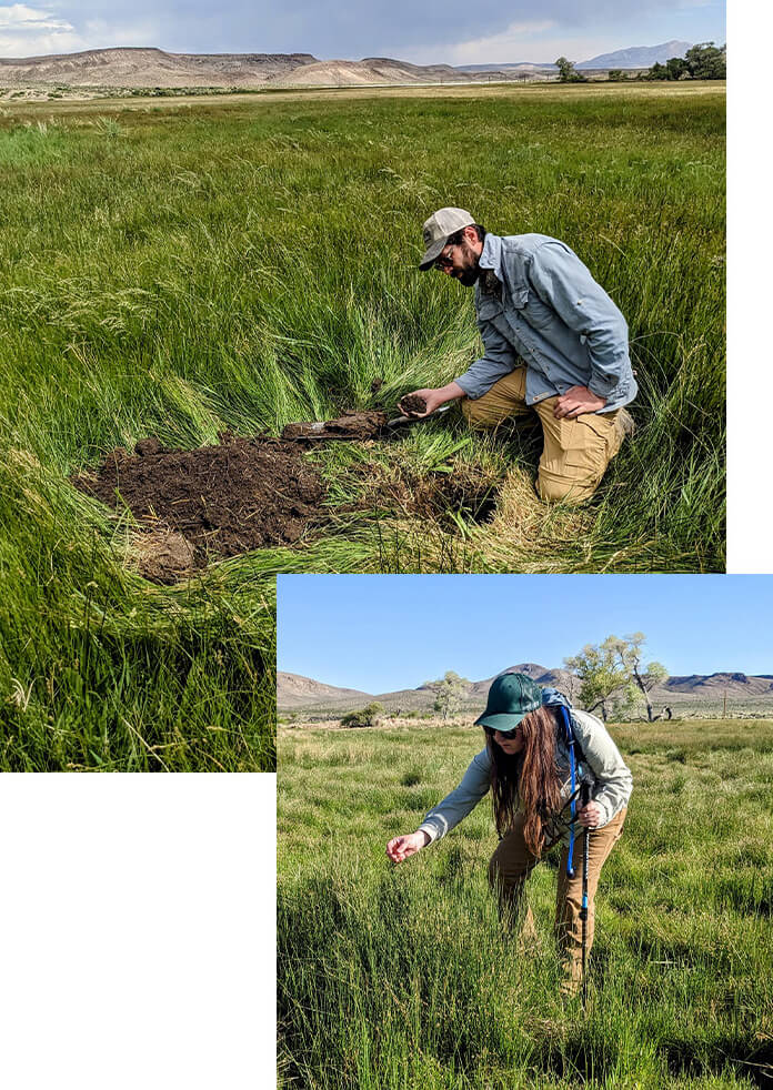
Silver Sage Eco is trained in wetland delineation techniques from the Wetland Training Institute as specified by the United States Army Corps of Engineers (USACE), including identifying and categorizing wetland vegetation, determining hydric soils, evaluating wetland hydrology, and employing methods for making jurisdictional determinations.
Wetland delineation in arid regions present unique challenges due to the scarcity and intermittent nature of water and characteristics of local soil types. It is crucial to accurately identify and delineate wetlands for effective conservation and regulatory compliance.
Key steps and considerations for wetland delineation in the arid west include:
- Understanding the specific characteristics of wetlands in arid regions, which may include playas, intermittent streams, seeps, springs, and seasonal wetlands.
- Following federal and state regulations related to wetland delineation (e.g., Clean Water Act) and guidelines provided by agencies such as the U.S. Army Corps of Engineers and the Environmental Protection Agency (EPA).
- Assessing surface and subsurface hydrology to determine the presence, duration, and frequency of water in the area, considering seasonal variations.
- Identifying and documenting plant species in the area, focusing on wetland indicators or hydrophytic vegetation that are adapted to wet conditions.
- Conducting soil investigations to assess soil characteristics, including color, texture, redox features, and other evidence of hydric soil indicators.
- Analyzing the landform and topography of the area to understand landscape position and potential hydrologic influence on wetlands.
- Preparation of a comprehensive wetland delineation report detailing the methodology, data collected, wetland boundaries, and supporting evidence.
- Ensuring compliance with regulatory requirements and, if necessary, develop mitigation plans to offset potential impacts to wetlands.
Ecological Site Verifications
An ecological site verification is often required as a component of baseline biological surveys, and involves assessing and confirming the ecological characteristics of specific land areas to understand their unique ecological potential and guide sustainable land management practices.
Ecological Site Verifications consider:
- Soil map unit components including horizons, texture, and structure
- Topography and landform arrangement in relation to hydrology and soil development
- Vegetation composition including species type, cover, and growth habit
- Ground cover and category of inorganic components
- Climatic components including precipitation and temperature variance
- Ecological dynamics of plant communities and their associated resistance and resilience to anthropogenic and natural disturbances


Spring Surveys & Sampling
The Great Basin region is known for its unique geological and hydrological characteristics, including numerous springs. In arid and semi-arid regions, springs are critical hydrological features that are essential for providing water to both natural ecosystems and civilization.
Silver Sage Eco has experience in assessing springs using a variety of techniques:
- Springs Stewardship Institute (SSI) Springs Inventory and Assessment
- Springs ecosystem type classification
- Assessment of anthropogenic impacts
- Level I & II inventory protocols for botanical, geographic, and hydrologic analyses
- Springs Ecosystem Assessment Protocols (SEAP)
- Surface water flow measurements and sample collection for laboratory analyses
- Detailed springs boundary mapping using Evapotranspiration Unit (ET) metrics
Soil Sampling, Analysis & Reporting
In-depth soil sampling may be required as a component of larger land assessments. Silver Sage Eco has experience in completing soil management reports in compliance with local and federal mandates, conducting soil analyses during wetland and spring surveys, and verifying soil components in relation to mapped official NRCS soil surveys.
Soil Management Reports
- Study design
- Sample collection
- Interpretation of lab analysis results
- Report compilation
Wetland and Spring Surveys
- Hydric soil identification
- Soil hue, value and chroma measurements
- Redoximorphic features evaluation
Soil Pit Verifications
- Soil horizon delineation
- Soil texture and structure determination
- Soil series description correlation
Proper Functioning Condition Assessment for Lentic & Lotic Areas
PFC assessments for lentic and lotic ecosystems are crucial for understanding the health, ecological processes, and functionality of these environments. Assessments of the condition of riparian-wetland areas considering hydrology, vegetation, and soil/geomorphic attributes can be used to inform adaptive management decisions or restoration efforts:
Hydrology
In lentic systems, determining if an area is periodically inundated or has saturated soils during the growing season with evident characteristics that the presence of water has an overriding influence on vegetation and soils.
In lotic systems, determining stream functionality in relation to erosion and sediment transport, channel morphology, energy dissipation, and ability to sustain appropriate and adequate vegetation.
Vegetation
The vegetation component of PFC determines how vegetation type, cover, or density contribute to functionality. Plant density, community development, and distribution of stabilizing vegetation species along hydrologic margins are major factors affecting the development and protection of lentic and lotic systems.
Geomorphology & Soil Erosion/Deposition
An important objective of the PFC assessment methodology is determining if stream channels and connected riparian areas are stable, and soil and geomorphic attributes and processes must be considered.
Landscape position and nearby landforms which influence the source of and movement of water are evaluated, along with erosional and depositional attributes and processes such as sediment load, discharge, and stream energy.